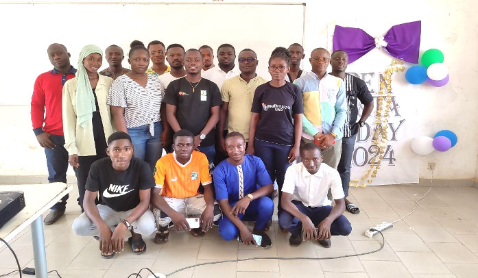
As part of Open Data Day 2024, the YouthMappersUAO chapter (Côte d’Ivoire), in collaboration with the Open Knowledge Foundation (OKFN), organized a water point mapping activity in the city of Bouaké called “Water Point Mapping Day”. The event aimed to train and build the capacity of participants to collect data using Open Source tools, and to map water points in the city of Bouaké. The activity took place over two (2) days. Friday 08 and Saturday 09 March 2024 in Bouaké. On the first day, we were in the American Corner room of the University Alassane Ouattara de Bouaké (UAO), and on the second day, we were in the “cité forestière” in the town of Bouaké. The twenty (2O) participants were reminded of the context of the day: Open Data Day (ODD), the Open Knowledge Foundation, the prerogatives of the YouthMappers community in general, but also the vision of the YouthMappersUAO chapter. They were amazed by the ideology of Open Data, especially for our developing countries, but especially for students enrolled in operational research frameworks in various university courses.
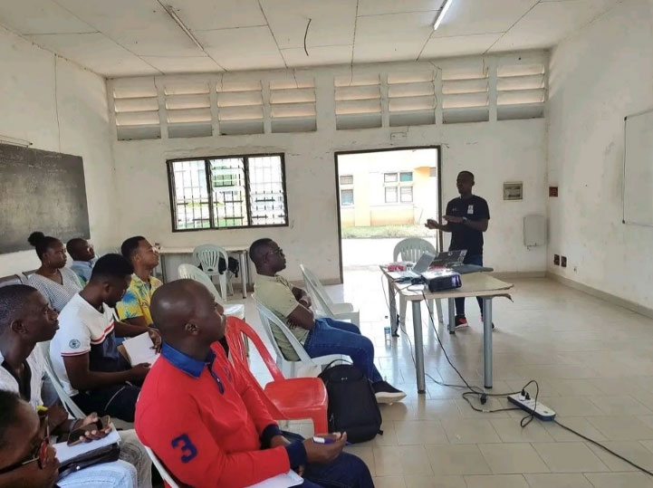
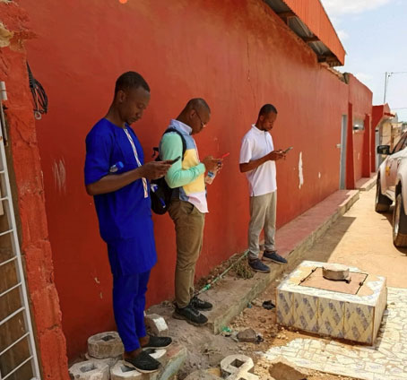
After the introductions, the day’s data collection tools were presented. Mardoché Azongnibo presented the two (2) applications to be used to carry out the activity. These were #Osmtracker and #KoboCollect. A practical session was organized for the two (2) applications. We were able to observe the applications’ settings, including GPS accuracy for good-quality coordinates. After this session, we went out into the field to collect data in groups of four (4) teams, with one team of 5 members.
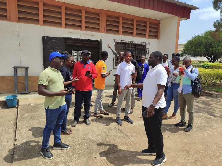
The day continued with the essential part of the activity, which focused on data collection. In practice, the town of Bouaké, with a surface area of 177,000 hectares, has been divided into four (4) sub-areas. Bouaké South-East, Bouaké South-West, Bouaké North-East and Bouaké North-West. Given the size of the city, we collected data in two (2) parts of the city: Bouaké South-East and Bouaké South-West.
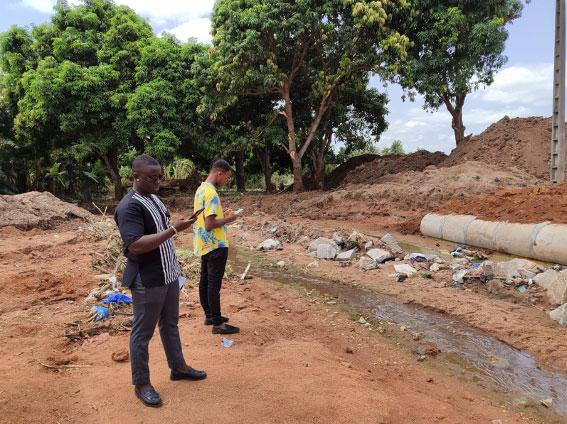
The applications examined were put to good use when collecting data in the field. Participants were able to collect different types of water points throughout the day in the respective areas. From wells to streams, all were collected to update the map of water points in the city of Bouaké. A form edited in Kobotoolbox was used to categorize the different types of water points during the collection with KoboCollect.
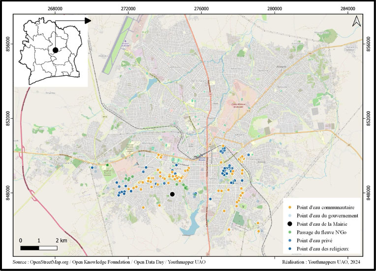
A total of 163 water points were collected in Bouaké south. Each participant played an essential role in this collaborative activity.
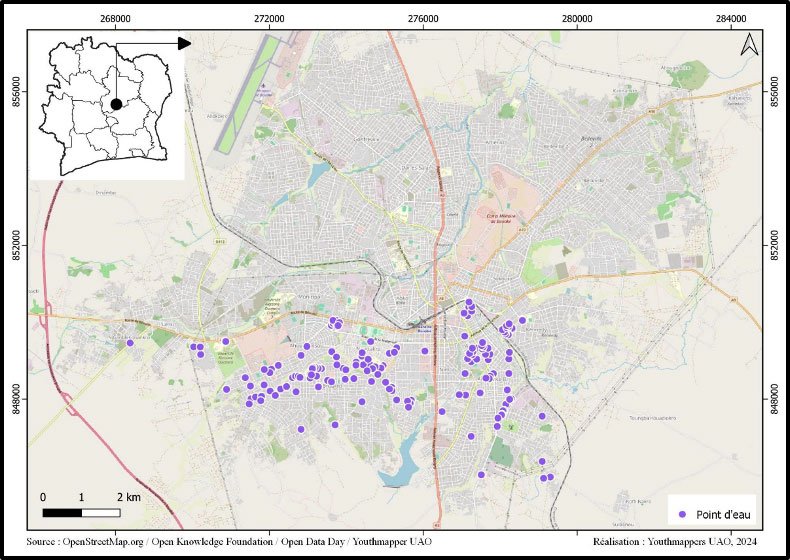
Most of the 163 water points collected were built by the community. 88 water points were built by the community, 27 by religious leaders, and 19 by religious leaders. The rest were built by the government and natural water points. Thanks to the commitment and willingness of all concerned, a significant amount of data has been collected, enabling a more accurate and comprehensive map of the water points in the southern part of the city to be created.
The balanced involvement of men and women demonstrates the importance of diversity and inclusion in such community initiatives.
In conclusion, the event was a great success and provided valuable information in the field of water points. This accurate information will be used to create a participatory map of farmers’ access to water during periods of drought in Bouaké, to improve both the quantity and quality of the OpenStreetMap database. The event was greatly appreciated by the participants, who shared their experiences and knowledge, enabling the public to get involved and learn.
About Open Data Day
Open Data Day (ODD) is an annual celebration of open data all over the world. Groups from many countries create local events on the day where they will use open data in their communities.
As a way to increase the representation of different cultures, since 2023 we offer the opportunity for organisations to host an Open Data Day event on the best date within a one-week period. In 2024, a total of 287 events happened all over the world between March 2nd-8th, in 60+ countries using 15 different languages.
All outputs are open for everyone to use and re-use.
In 2024, Open Data Day was also a part of the HOT OpenSummit ’23-24 initiative, a creative programme of global event collaborations that leverages experience, passion and connection to drive strong networks and collective action across the humanitarian open mapping movement
For more information, you can reach out to the Open Knowledge Foundation team by emailing opendataday@okfn.org. You can also join the Open Data Day Google Group to ask for advice or share tips and get connected with others.